Western Gate
The principal arrival point from Rillford and the western road.
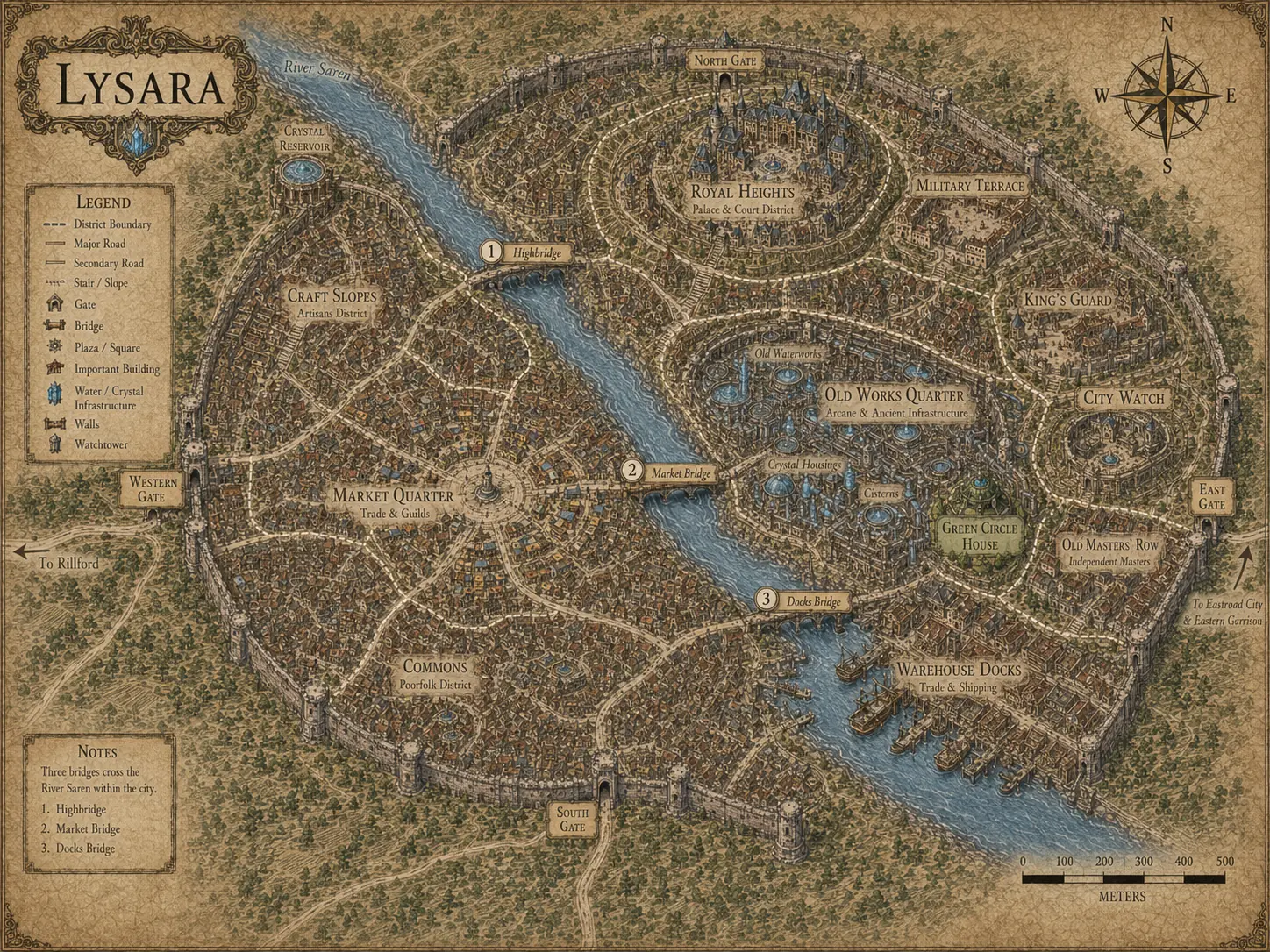
Approved city map
Follow the Saren through the walls, trace the three bridges and see how Lysara rises from freight and workshops toward military and royal power.
Place guide
The list below provides a readable companion to the labels on the map.
The principal arrival point from Rillford and the western road.
Trade, guilds and the city’s busiest mixed movement.
Dense housing, work and everyday dependence on public systems.
West-bank workshops and practical trades above the river.
A narrower crossing for pedestrians and lighter loads.
The main mixed-traffic route across the Saren.
The freight-oriented link beside the warehouse riverfront.
Barges, ramps, porters and bulk storage.
Barracks, yards, administration, armouries and stables.
The upper geography of court and Crown authority.