Rillford
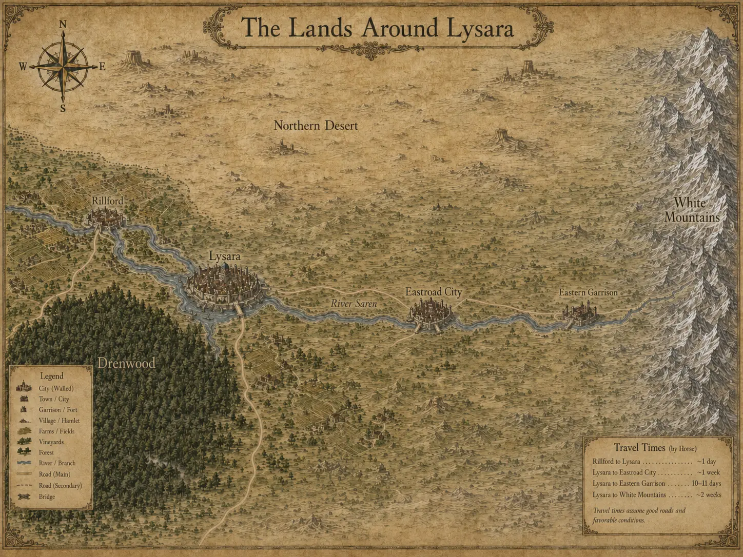
A vineyard town about one day's ride west of Lysara.
Approved regional map
Follow the Saren from Rillford past Lysara and eastward, with Drenwood to the south-west and the White Mountains marking the far horizon.
Place guide
A readable companion to the engraved labels.
A vineyard town about one day's ride west of Lysara.
The old forest south-west of the capital and along Rillford's cultivated edge.
Ardena's walled river capital.
The water and transport spine linking settlement, field and city.
The principal city on the eastern route shown on the approved map.
A fortified point farther along the road toward the mountains.
The high eastern barrier beyond the settled road.
The dry country north of the Saren corridor.